HISTORIC SITE MAP
This is a historic map of the Topaz Camp which was located 16 miles northwest of Delta in central Utah, on the lip of the Great Basin. Topaz had a peak population of 8,100 and recorded 11,212 people processed through the camp while it was in operation from September 11, 1942 to October 31, 1945.
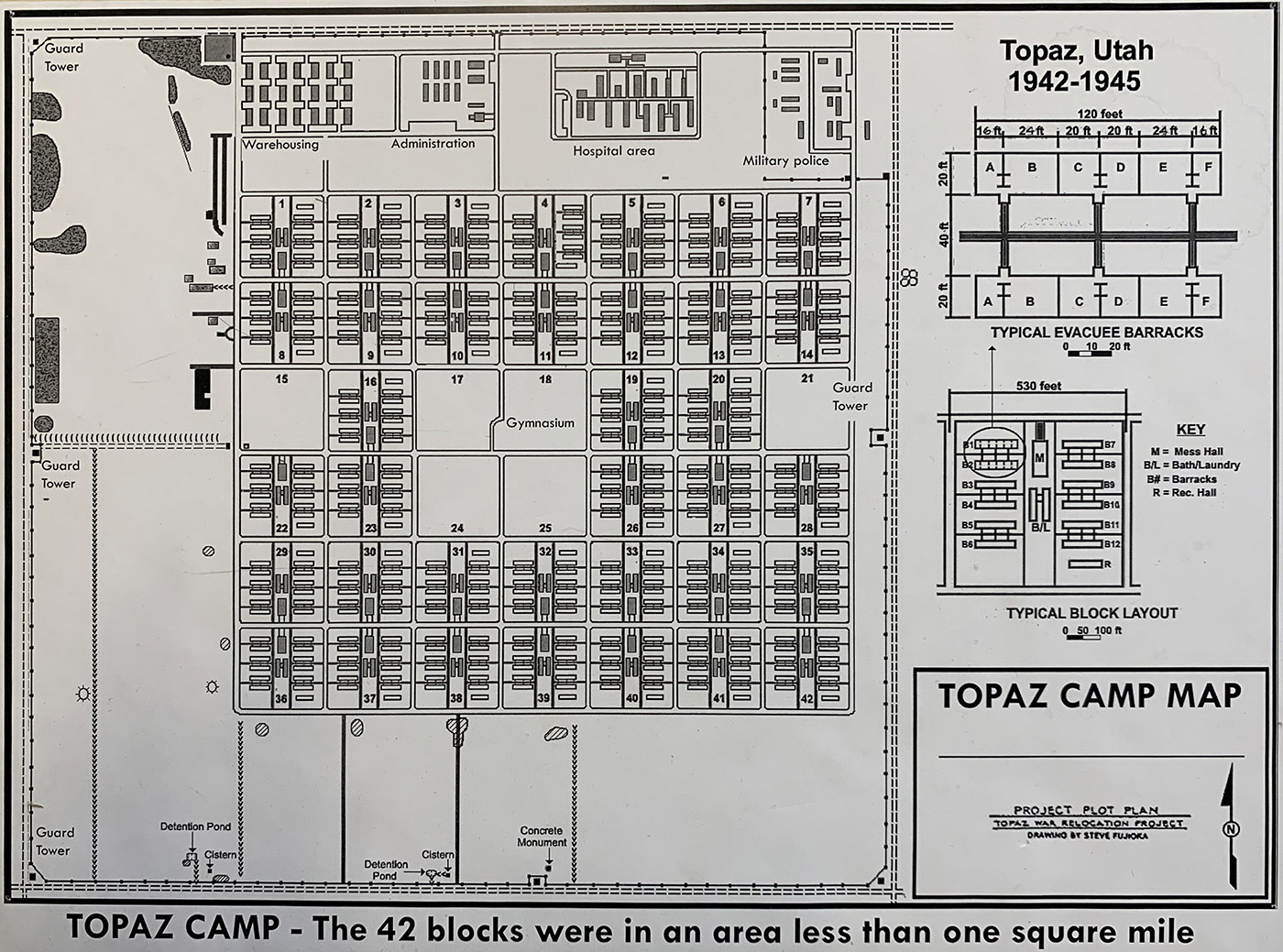

Photo: Brian Buroker
Help Support Our Museum
HISTORIC SITE MAP
This is a historic map of the Topaz Camp which was located 16 miles northwest of Delta in central Utah, on the lip of the Great Basin. Topaz had a peak population of 8,100 and recorded 11,212 people processed through the camp while it was in operation from September 11, 1942 to October 31, 1945.
Photo: Brian Buroker